Saturday: Sep 3, 2011
(from Reykjavik to Vik i Myrdal)
We left Reykjavik on Saturday morning heading roughly northeast.
Soon after we left the
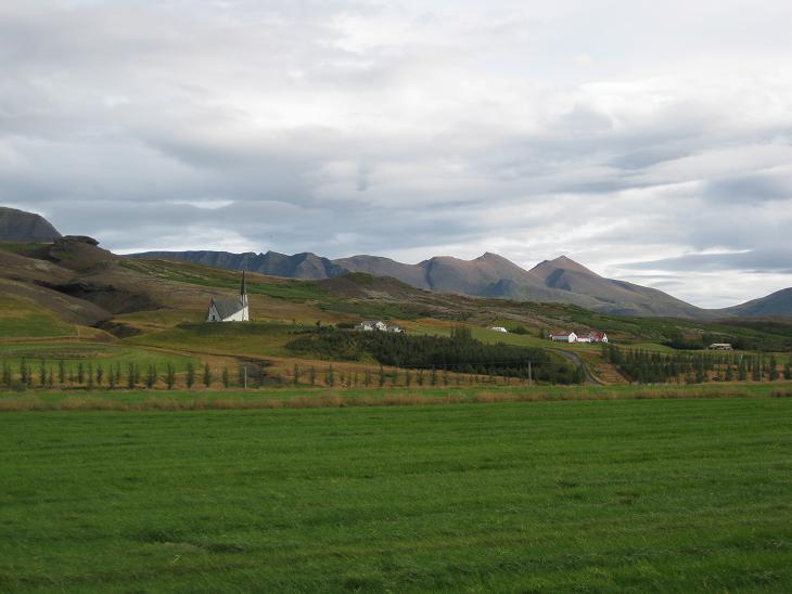
developed suburban areas we came to a roadside stop which presented us
with a visual abstract of the whole island - a church,
a farm and brooding mountains in the background. We could have just turned around
and fly right back home and still have that warm satisfying feeling that
we had seen the essence of Iceland.
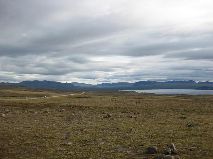
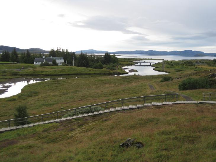
Our first destination was the area
known as Thingvellir which lies just behing Thingvallavatn Lake.
Many visitors
stop here by the lake to pack the first horizonful of
raw Icelandic beauty onto their memory cards.
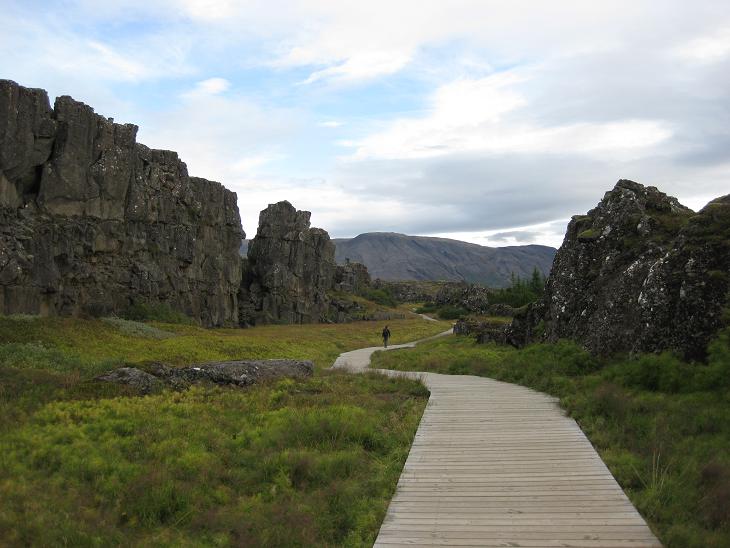
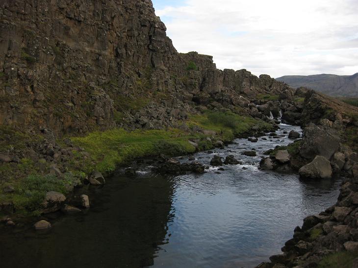
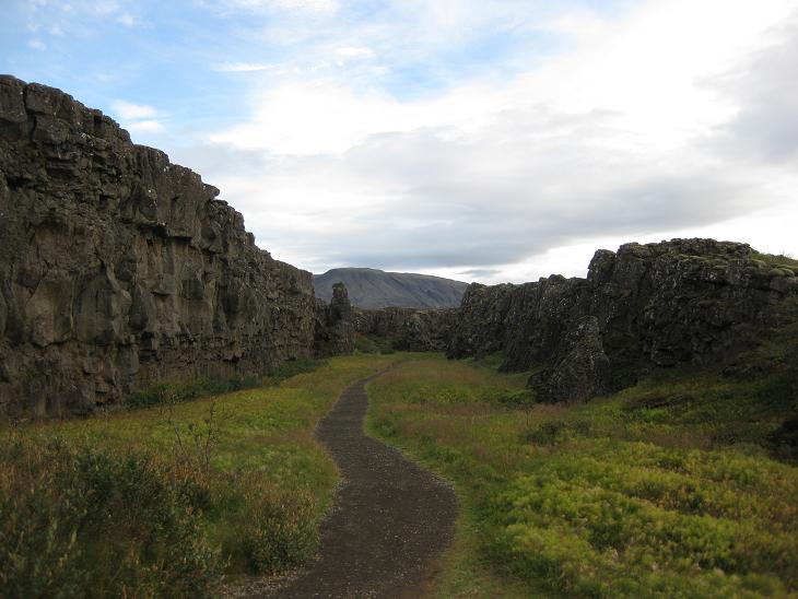
Thingvellir lies along the suture joining
the American and European tectonic plates.
On the left you have the American plate and on the right the European one.
If you camped here for a decade or so
and measured the distance between the rocks every year,
you'd find that they are slowly spreading apart -
the American one is moving to the left,
and the European one to the right (if you wanted to have it politically correct,
you'd have to turn back and walk in the opposite direction).
The boardwalk is not terribly long,
but for those who think that hiking smack between
Europe and America is their kind of thrill,
a continuing dirt path provides
further opportunities for joywalking.
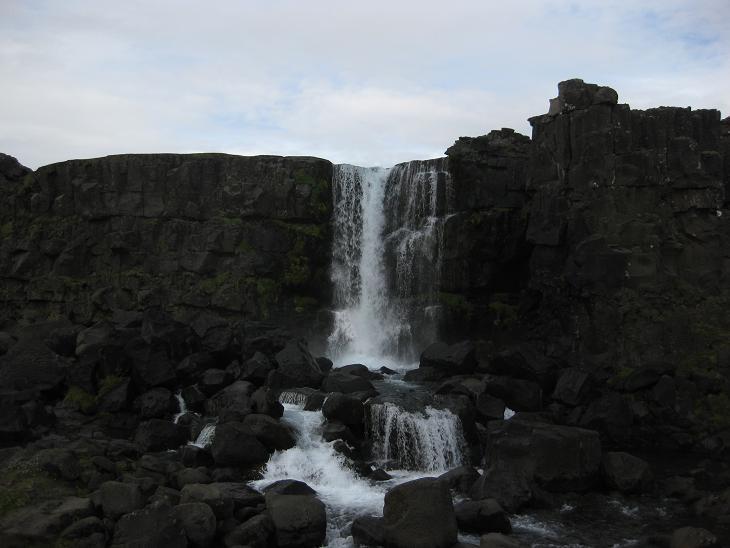
At this point, I should probably mention
that in Iceland waterfalls are kind of like French fries -
they are automatically added to all tourist attractions
whether you like them or not. The one that was
tacked on to Thingvellir was a stylish "cascade noire" on the Oxara river.
If it wasn't for the hints of blue in the sky, its almost black and white
character would make me feel like a real French photographer.
Definitely worth a short and rather pleasant hike
from the parking lot.
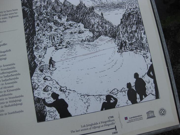
The Oxara river which forms the above waterfall is responsible
for another page of Thingvellir Noir: the Drowning Pool -
a deeper and calmer stretch of the river where women
found guilty of adultery
were drowned in the Middle Ages. The mechanics of this gruesome procedure was
depicted on a plain contemporary drawing displayed
on an information board.
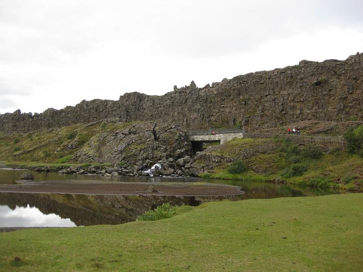
Thingvellir is also a place of great historical significance.
It was here where the first European parliament, the Althingy, was founded in 930.
Only after a major earthquake in the 18th century was
the parliament transferred to Reykjavik. Many large celebratory gatherings
of the Icelandic people take place in the vicinity of these historical grounds.
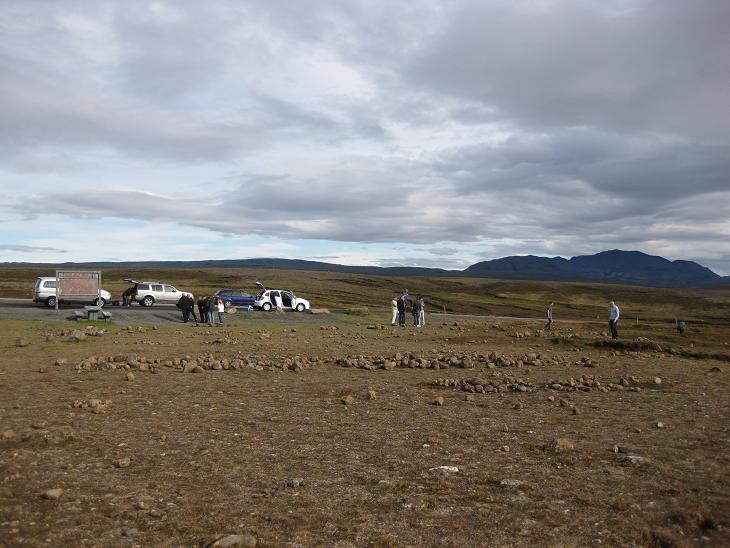
Don't be surprised if you come across wandering herds of strange two legged animals.
Those are tourists, a major introduced species in Iceland.
You can see them roaming freely along the Golden Circle -
a route connecting several attractive destinations just east of Reykjavik
(including Thingvellir, Geysir and Gullfoss).
Since these places can be reached easily from the capital, many hotels organize
day trips alongside the route - and that in turn aggravates the overall infestation.
Once you move past Selfoss, it will get better.
You are not supposed to feed them, by the way - if you do,
they may hit you with an umbrella.
Same goes for scratching under their chin
(this is the same place
shot from below after the locusts left - so you can appreciate the difference).
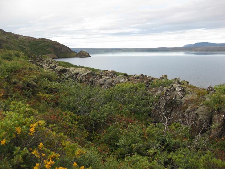
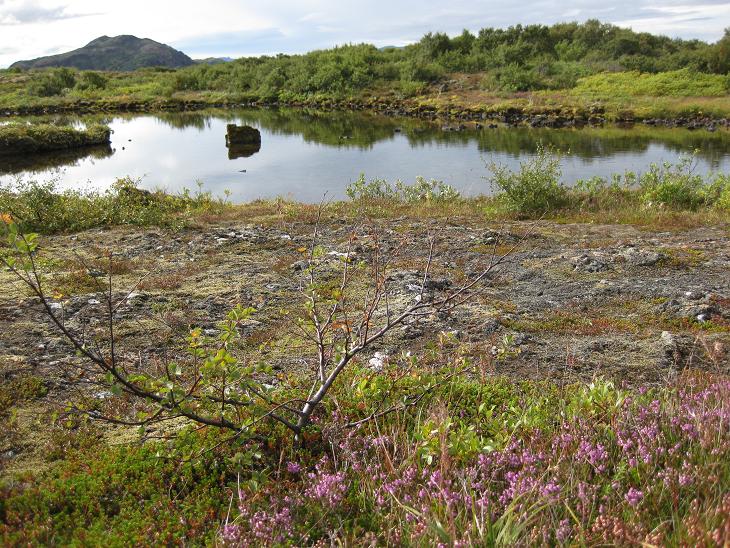
From Thingvellir we continued our journey East and briefly skirted
the southeastern shore of the Thingvallavatn Lake and its many
attendant pools.
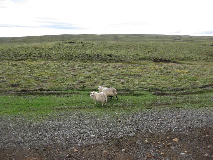
Iceland does not have many trees so the elegantly smooth landscape
is punctuated only by occasional outcroppings of woolly sheepishness.
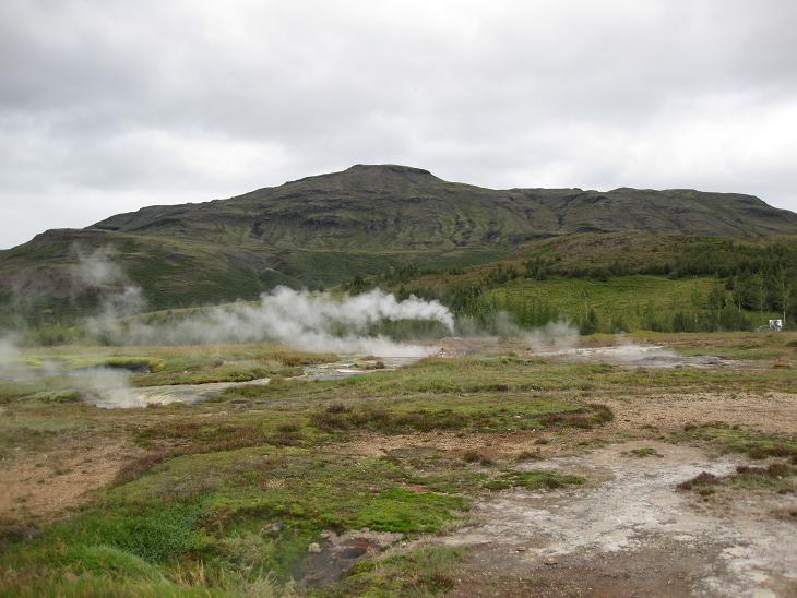
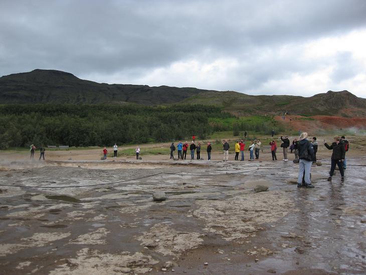
A group of steamy vents visible from the road alerted us to the fact that
we were entering our first geothermal field -
home of the hot spring Geysir that gave name to its many brethren all over the world.
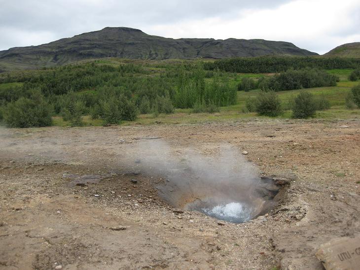
Some of the geysers were just small bubbling puddles of hot water
begging for a bag of Earl Gray...
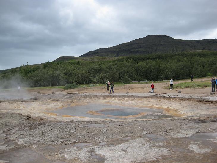
...but some were much larger and surrounded by
water paparazzis patiently
waiting for some clickable antics.
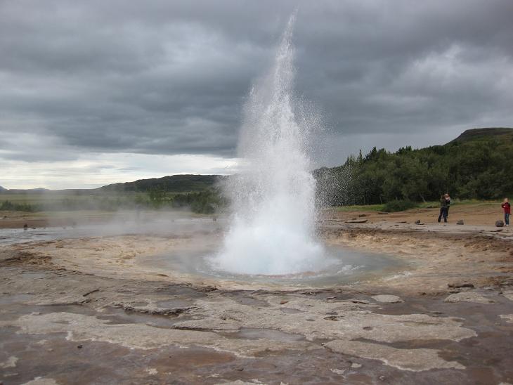
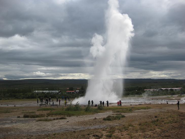
One of the geysers, named Strokkur, fulfilled their desires roughly every 15 minutes,
so it was not very difficult to capture it in action (Geysir itself erupts only rarely).
The crowd celebrated the appearance of waterworks with loud cheers and
merry JPEG making.
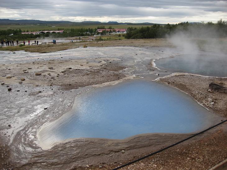
The whole area looked like a miniature copy of Yellowstone.
It smelled like one too.
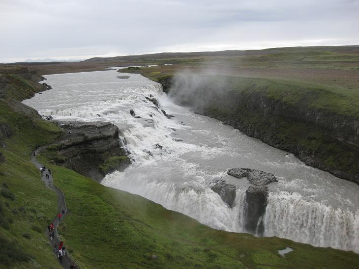
A short drive up the road from the Geysir region takes you to Gullfoss,
one of Iceland's
most visited waterfalls.
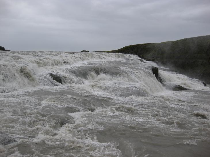
The waterfall has two sections, the upper one -
which is really a monumental white water cascade...
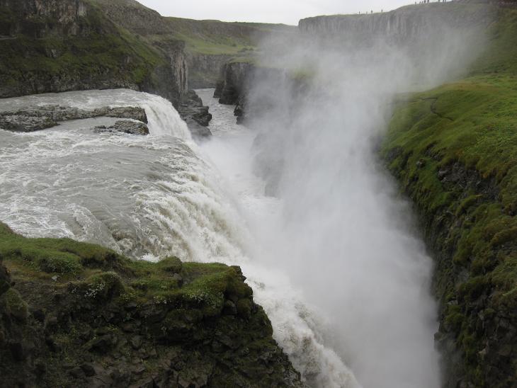
...and the lower one - where the water actually falls into a deep and narrow gorge.
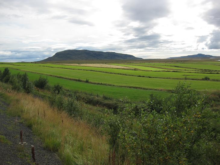
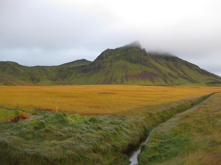
At Gullfoss we changed the course and started heading south through pastures
and meadows surrounding Hekla, the most famous
Icelandic volcano. It errupts fairly regularly once a decade or so,
the last eruption on Feb 26, 2000
lasting 12 days. Hekla means "the hooded one" and you can indeed barely
see its top hidden in multiple layers of rain-waiting-to-happen.
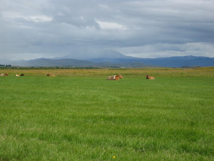
After a fairly cloudy day at Reykjavik, we weren't particularly anxious
to further study indigenous vaporforms so we continued south to southwest
past unexpectedly lush farmlands whose green tones were
evocative of much milder climes.
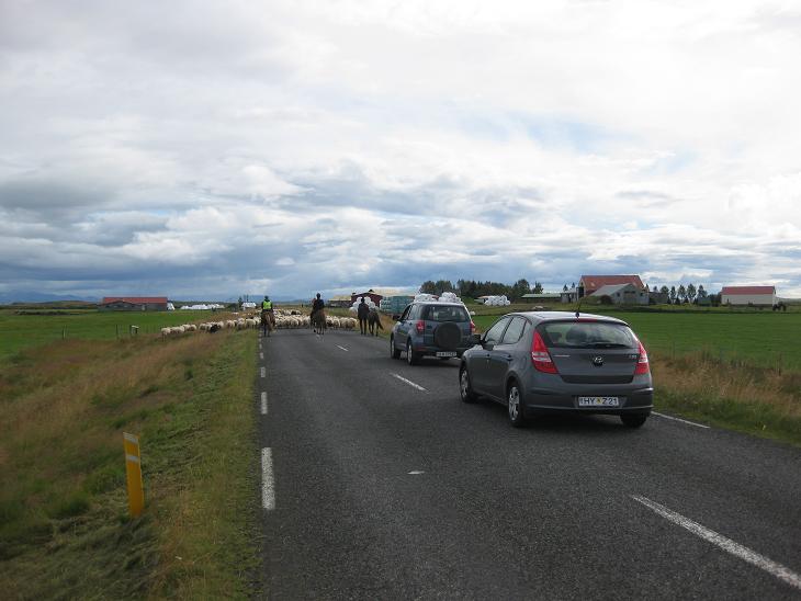
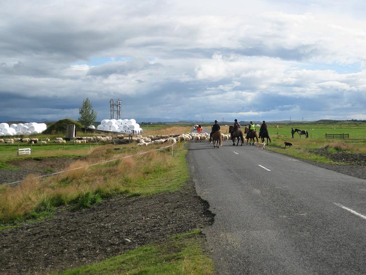
This is what a traffic jam in this part of the Universe looks like
(they call it head-to-ham instead of bumper-to-bumper), but it usually gets
resolved pretty quickly.
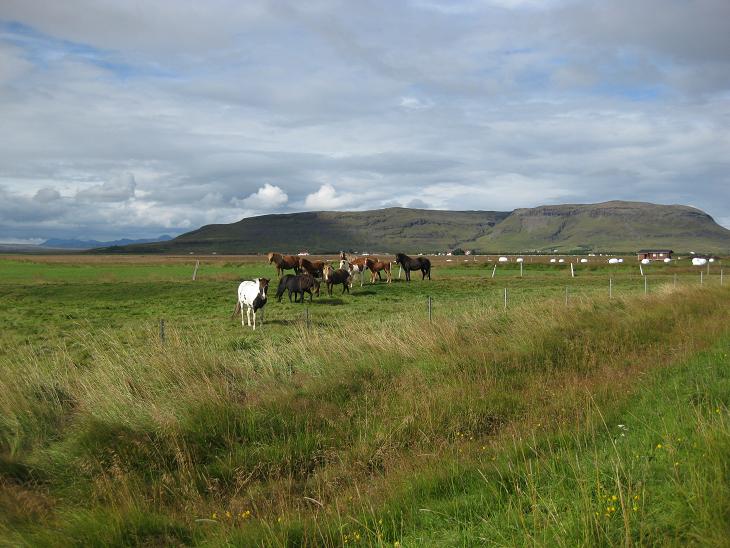
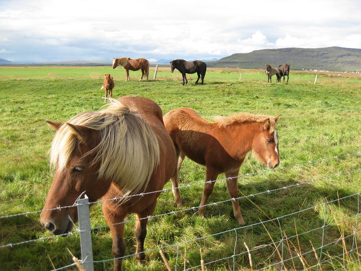
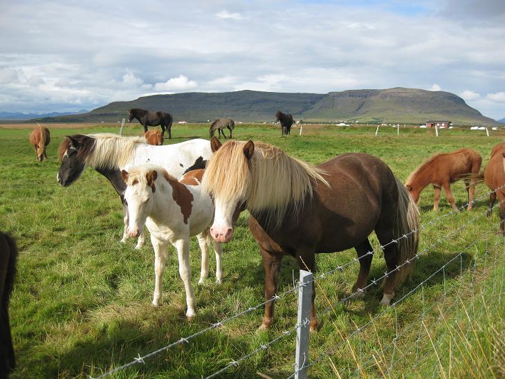
Besides tourists and sheep, the most common herding animal in Iceland
is a special kind of horse...
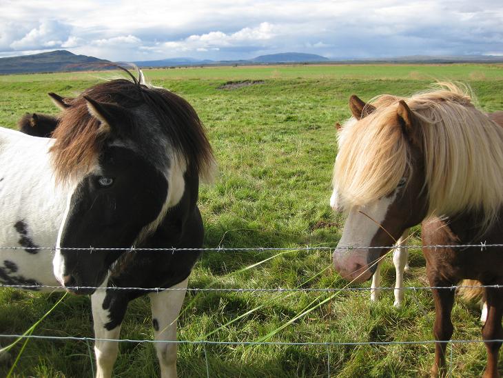
...a hardy and small,
almost pony sized, variety that you won't
find anywhere else in the world
(here is the shy foal
that hides behind Mommy).
Every once in a while we took a side road to make quick exploratory trip
towards the mountains,
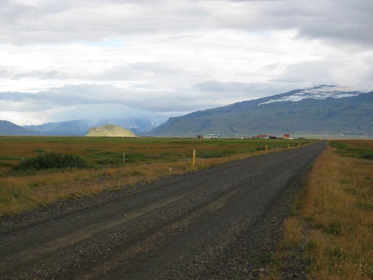
but mostly we stayed on road 1 (the Ring Road)
which circles the whole island.
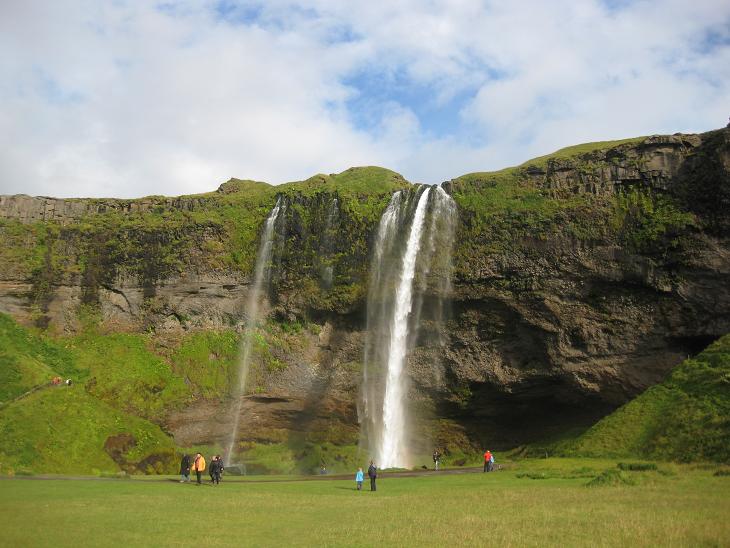
Around 4pm we reached the region of the infamous volcano Eyjafjallajokull where
the weather beautifully cleared just in time for some photo-ops at
the Seljalandsfoss waterfall.
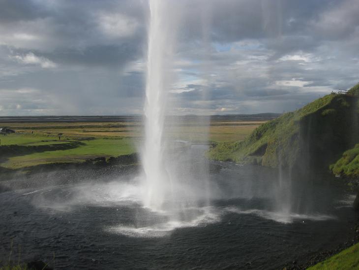
The nice thing about this waterfall is that you can take a short
trail that circles around it.
Backstage pass always offers a different perspective.
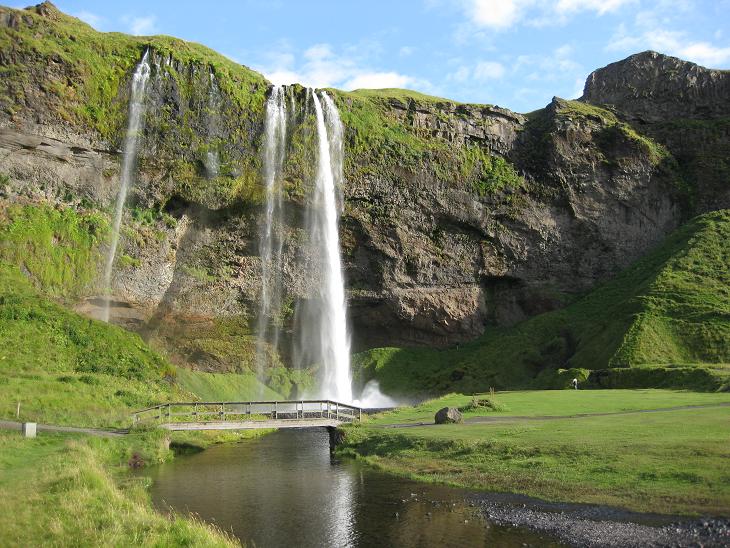
After you take a photo of the waterfall from each of the 360 available angles,
you emerge on the other side
and have to
cross this wooden pedestrian bridge to get back to the parking lot.
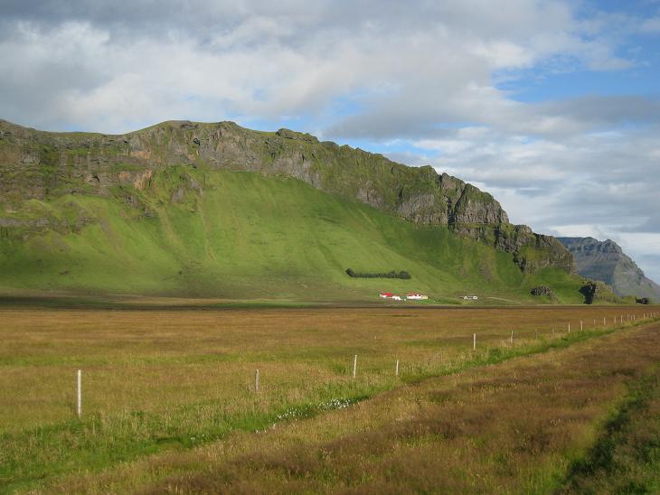
As you continue East on the Ring Road you will see mountains on the left most
of the time
(there are many examples of this prototypical view in the
Road Series).
Note the strip of trees just above the farm which shields it from avalanches.
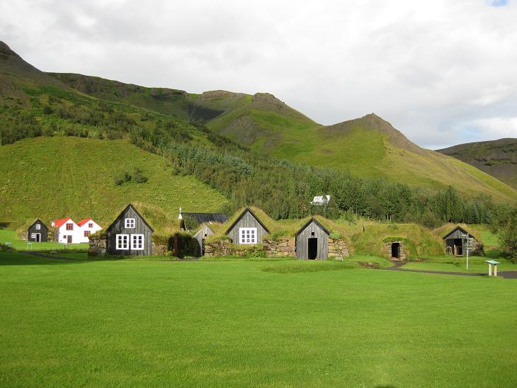
Next stop on the Ring Road was an open air Folk Museum in Skogar.
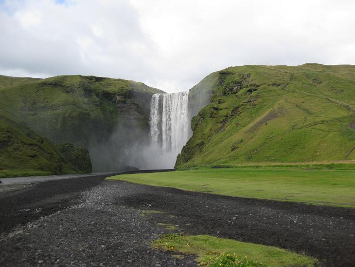
Did I mention that in Iceland every major tourist attraction comes
with its own waterfall?
This is Skogafoss (60 m/200 ft), about half a mile from the museum
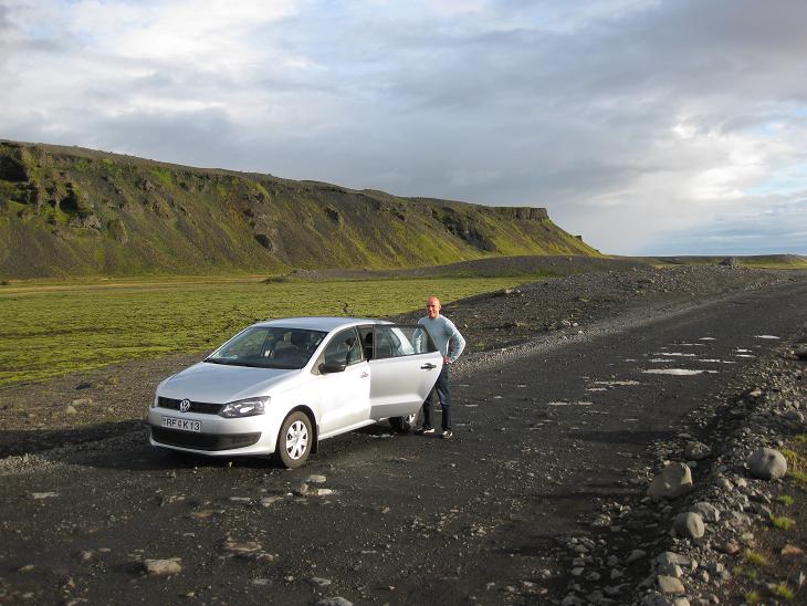
Shortly after Skogar we spotted side road 221 which - according to our map -
led towards one of the protruding tongues of the Myrdalsjokull glacier.
Intrigued by the idea of a drive through glacier we took the road and soon
discovered that it was one of the worst drags on the whole island.
Judging by the amount of potholes per mile, this dirtroad
must have recently been used as training grounds for NATO's elite tank divisions.
We got about 5 miles into it and called it quits. Before our Volkswagen would.
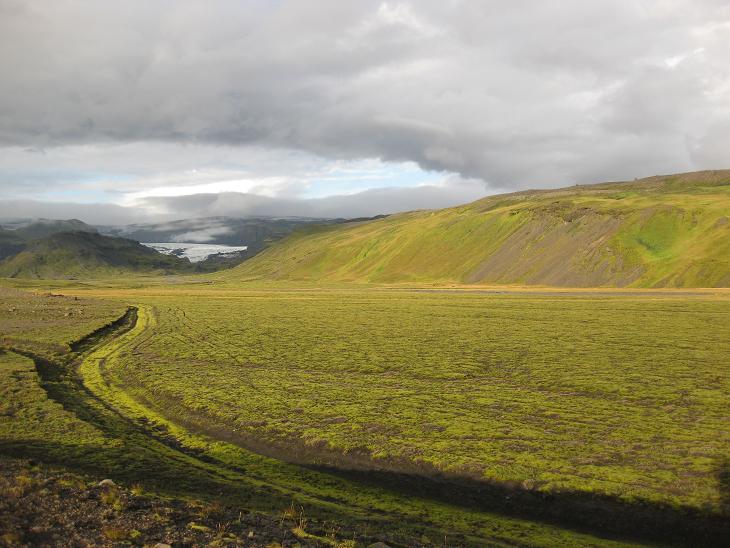
All we got for the effort was this measly shot of the glacier
from a very respectful distance.
Around 6.30pm we reached our final destination - the Hofdabrekka farm,
about 5 miles past Vik i Myrdal on the Ring Road.
After we unpacked, we took a short evening trip to a nearby black sand beach.
Vik i Myrdal is on the southernmost tip of Iceland and sports a pretty balmy weather
(mostly due to the Gulf stream).
Our car thermometer registered 15C and even the countryside seemed a tad lusher.
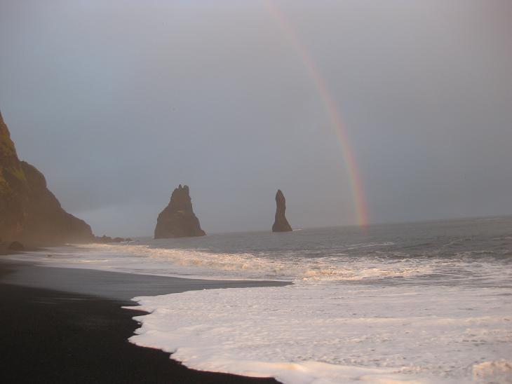
We took a big circle around
the Reynisfjall mountain and arrived at the beach adorned with the famous
rock columns Reynisdrangar that were supposedly formed when two trolls
were trying to pull a three masted ship onto the land (to get the rainbow,
you have to call the Reykjavik number 575-8993 and it will cost you extra 1500 ISK)
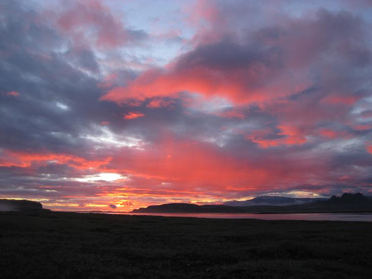
Since it was the sunset time, we hung around for a bit and then turned around
from where we were standing and captured our best Icelandic sunset.
Next ---
Index