Sunday: Sep 4, 2011
(from Vik i Myrdal to Hofn)
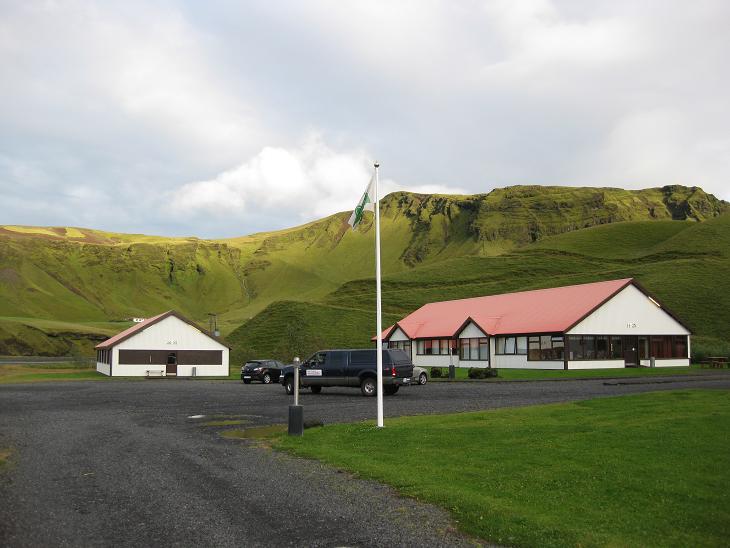
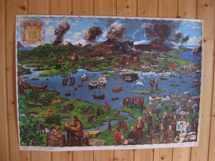
The morning at Hofdabrekka farm was crisp and relatively sunny.
Somewhere behind those mountains (about 10 miles) lies the formidable Katla,
a sub glacial central volcano buried underneath 400 m (1310 ft) of ice.
It errupts only every 40-80 years (last time in 1918), but when it does, the attendant
melting of the glacier causes catastrophic floods in the nearby plains
(the common room in our section contained an interesting depiction
of the volcanic activity in the 'hood).
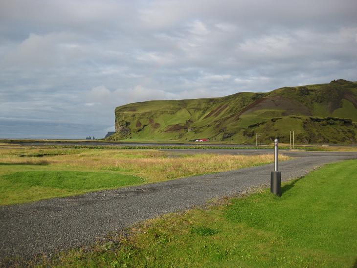
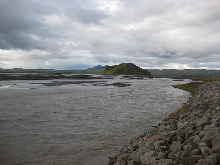
This is a view toward Vik. Vik itself is hidden behind the promontory,
but you can see
the rock formations that we were shooting at the end of the previous day.
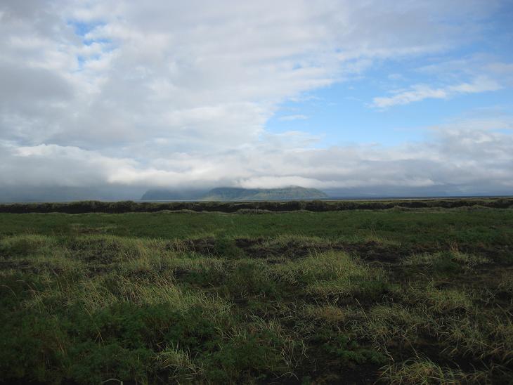
The first leg of today's trip traversed the stern semidesert of Myrdalssandur
formed by deposits of glacial floods caused by Katla's eruptions
(Katla herself is hidden far behind the clouds).
Our first destination was a small town Kirkjubaejarklaustur, which we shortened
to K-19 (K followed by 19 letters) to facilitate navigation.
Here is something you should know about Iceland:
cars are traveling faster than sound in selected regions
- you often arrive at a given town before you finish
pronouncing its name.
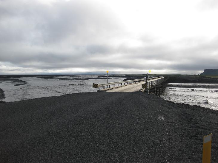
The fact that we were in the glacier country was made obvious by glacial rivers
which tore down several bridges recently, many of which were fixed only
temporarily. To give you a sense of the carnage:
the 1996 Grimsvotn eruption caused flows
of 50,000 m3/s (1,800,000 cu ft/s) - compared with the
normal summer peak flow of 200–400 m3/s (7,100–14,000 cu ft/s).
As you might imagine, the difference of two orders of magnitude
in the flow can do lots of nasty things to a poor unsuspecting bridge.
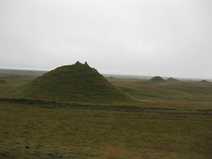
One of the side effects of numerous floods and land slides
were interesting formations alongside the road (I shot this one
from the moving vehicle, so you have to excuse its blurry appearance -
remember we are traveling faster than sound).
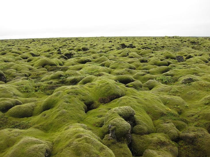
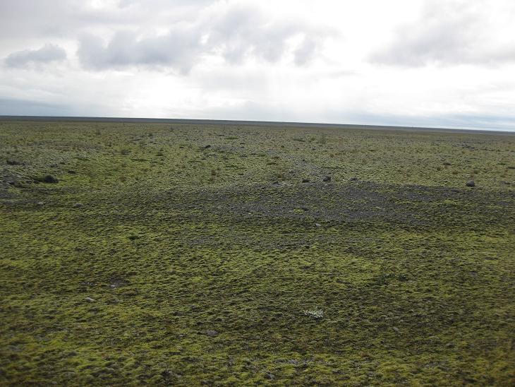
Just before K-19 we entered Skaftareldahraun, an old lava field
completely covered with thick moss (10-20 cm / 4-8 in).
This part of Iceland is every kid's dream.
You can hop and leap from a boulder to a boulder and
if you slip, the upholstery of the moss will soften your fall.
It's like a Grand Convention of Petrified Plush Animals.
Who knew that rocks could be soft and cuddly.
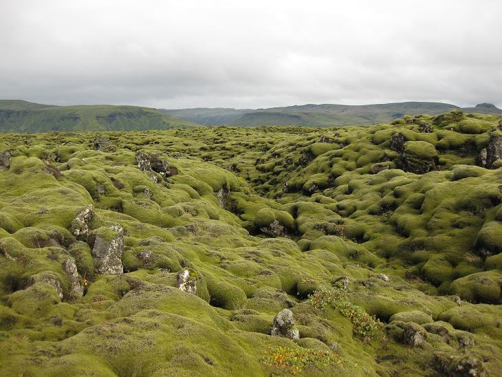
The most amazing thing about Skaftareldahraun was its seemingly infinite vastness.
Whichever way you looked, you saw only a green ocean of moss.
We had to drive at least 5 km before we started seeing some mountains behind it.
When I mentioned that major tourist attraction in Iceland came with
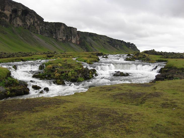
their own waterfall, I forgot to say that most farms had their own waterfall, too.
I am using the phrase "most farms" deliberately here, because during our trip
we actually found several farms that did not have any waterfall
in their vicinity whatsoever (frankly speaking, I find
this fact rather scandalous and I hope that the Icelandic Ministry of Tourism will
do something about it).

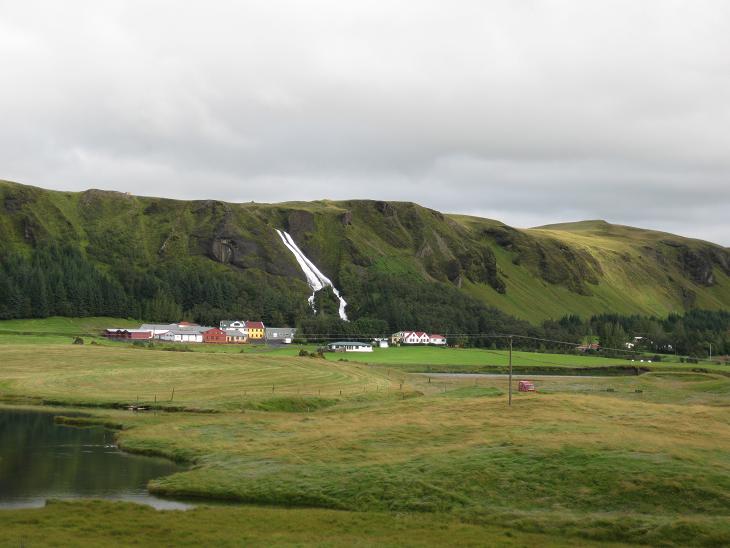
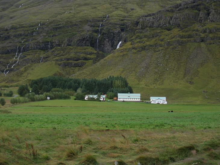
The countryside around K-19 was green and unexpectedly pleasant.
Not your stereotypical image of Iceland as a windtorn rock shivering in the cold ocean.
Directly ahead you can see two farms
(one partly obscured by a slope), each with its own waterfall as you might guess.
We even discovered one minor waterfall without any apparent
attraction or farm within sight.
Hopefully, some shrewd entrepreneur will take up this opportunity
and build a prosperous hedgehog farm or something
on that lovely meadow next to it.
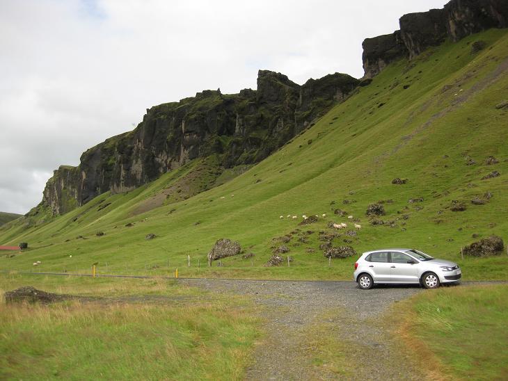
Although they look deceptive meek -
Icelandic sheep are into extreme sports. One them is obviously climbing.
We saw sheep grazing at some dangerously steep slopes and vertigo
inducing elevations.
Another one is playing chicken with motorists while bleeting blatant
disregard for all the incoming consequences.
Without dwelling too much on the legal and logical implications
of a sheep playing chicken, let me just say that if
"No Country for Old Men" was shot in Iceland, there would
be a scene there in which Javier Bardem barrels down the
Ring Road in a fully loaded semi, and upon seeing a happless piece of
mutton scampering along the roadside mutters heavily under his breath:
"Throttle or brake - call it, sheepo!"
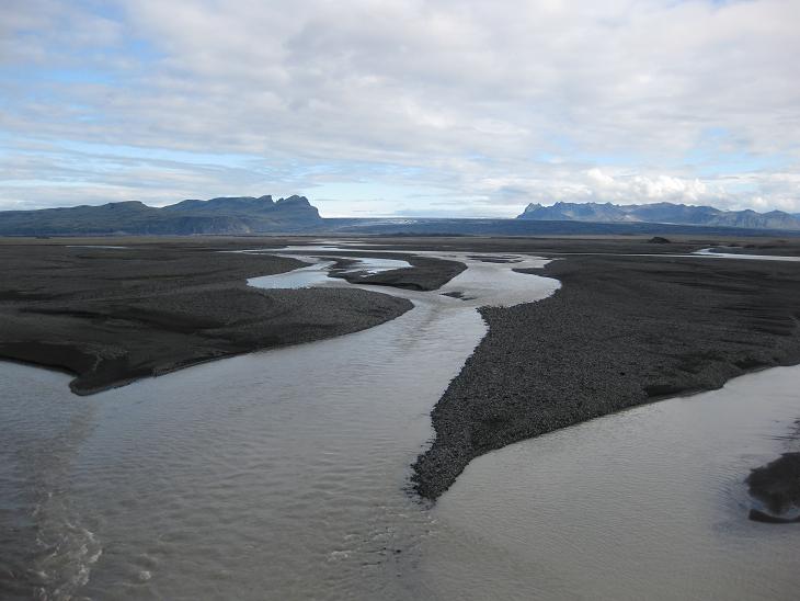
Glacial rivers
are usually shallow (geologically young), ramified and stretching
across large expanses of space. They form intricate braided stream complexes
whose total combined width can reach up to 30 miles (lookup Skeidararsandur on any
detailed map of southern Iceland or google it).
Southern Iceland does not have a problem with an urban sprawl.
It has a problem with a river sprawl.
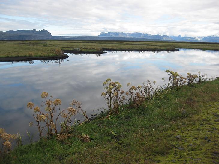
One byproduct of these sprawling rivers was a number of dead end
arms that got cut off from
the mainstream and formed elongated lakes.
Another byproduct was a monotonous plain of the glacial outwash.
When you drove along it, it
looked like an enormous industrial wasteland, easily 10 miles across.
Except it was all natural. Just dirt, volcanic ash, pieces of rocks
and sediments from a moraine deposited by the meltwater of glacial rivers.
The outwash is also a great testament to the powers and endurance of life.
Give it just a few years and colonies of mosses and simple plants
start marching across its inhospitable surface.
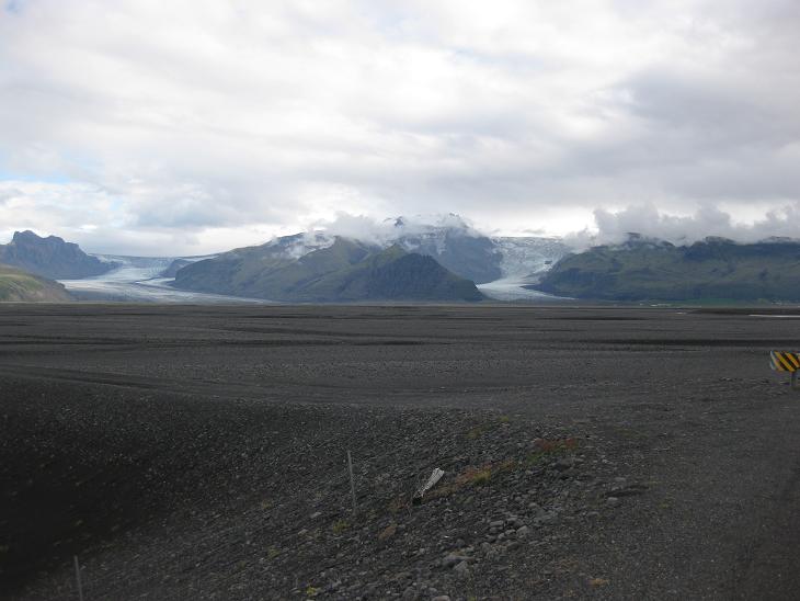
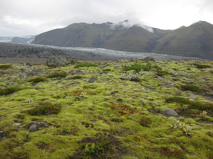
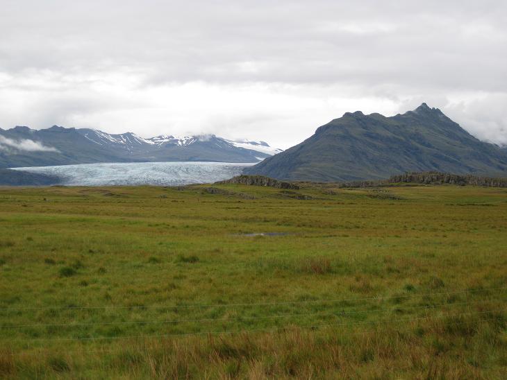
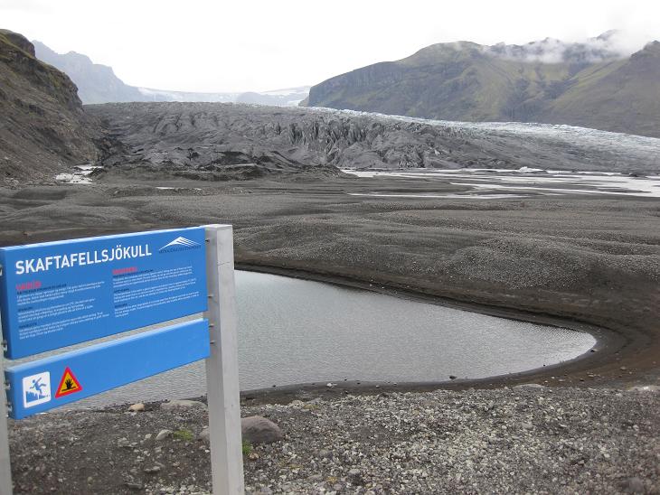
After passing the Skeidararsandur river system we arrived at Skaftafell,
a natural park at the Western end of Iceland's largest glacier, Vatnajokull.
We parked our car next to a ranger's station and went for a short hike
to one of Vatnajokull's protruding tongues (some experts call them "snouts").
Because of the recent volcanic activity the glacier itself was quite
dirty and covered with soot and ash,
but the surrounding tundra like vegetation shook off any signs of pollution and
was surprisingly green - once again a big testament to the indomitable spirit of life.
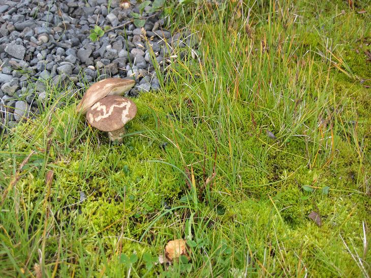
Embedded in a patch of moss, we even found one kind of edible musrooms
that we used to pick in Czechoslovakia. We called them "kozaci" (Cossacks).
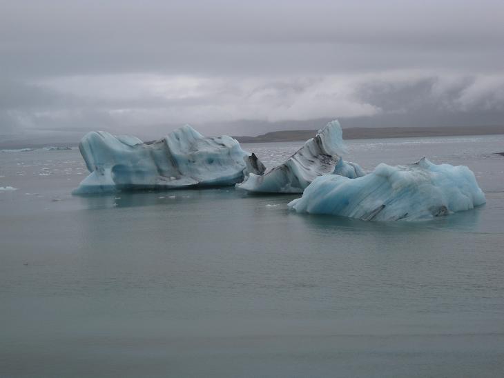
After Skaftafell it started raining, so we drove
straight on until we reached Jokulsarlon,
a glacial lake with bluish chunks of the glacier floating in its waters.
On a sunny day you can take a cruise boat and sail alongside the lake,
weaving your way among the little icebergs.
But our day was anything but sunny.
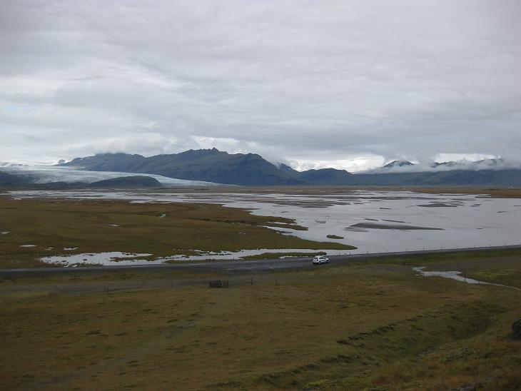
Our journey alongside the portion of Vatnajokull
exposed to the sourthern shore was well over 100 km (65 miles) long.
By now the general character of the landscape was deeply familiar to us.
Lots of shallow lakes or rivers, raw hills covered with hardy grass
and the mighty glacier in the background sticking its tongue deep
into the countryside with solemn determination.
A natural freezer for freshly cut ballads.
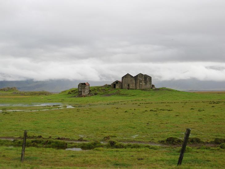
Farming underneath the mighty Vatnajokull is a tricky
business and a number of farms were abandoned and desolate...
...although here and there you could find one which managed to eke out a living
(and yes that white thingy above the farm is a partly obscured waterfall).
At long last, near the hamlet of Hoffell, we said good bye to Vatnajokull
and turned sharply south towards the ocean.
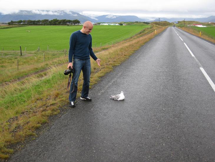
Southern Iceland has a special bird variety that we nicknamed "a suicidal tern".
Members of this species love to sit on the warm asphalt exactly at the location
through which a right tire track passes. And they mean it. They won't budge even
when you try to talk them out of it.
They just park stoically on their spot and brood glumly over inflation and
the increasing prices of small fish while waiting
for that fateful truck whose distracted driver won't make an effort
to avoid them. Needless to say that on roads around Hofn we saw a lot of
anatomical detail of birds whose suicidal mission was highly successful
(this is also the last photo where you can still see
Vatnajokull in the background).
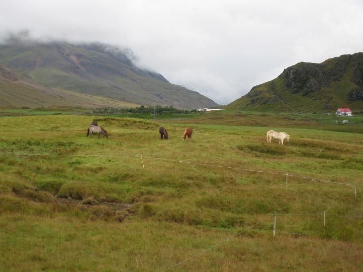
As we were approaching the warmer ocean (remember we
are still on the Gulf stream side of the island), there were more farms...
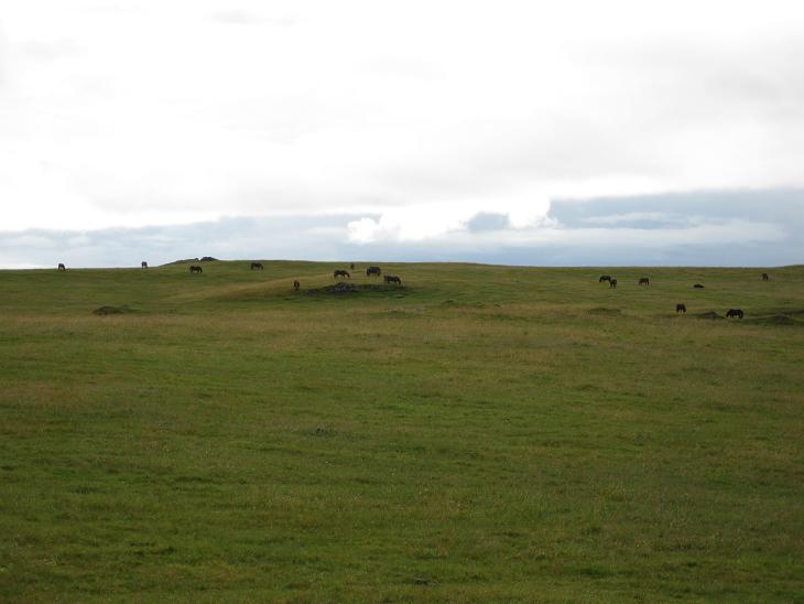
...and also more horses.
Many pastures were so vast and literally dotted with them that we
could not help wondering what were all those horses good for.
Was Iceland secretly preparing to take over the world with their cavalry?
Should we call Pentagon?
Around 4pm we arrived in Hofn...
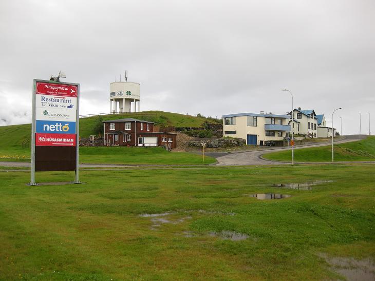
...a small fishing town with a population of around 2200.
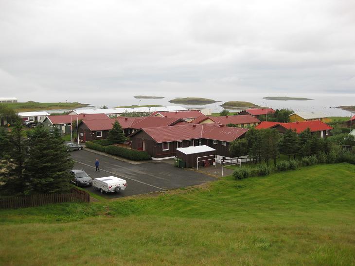
Hofn lies on a little peninsula...
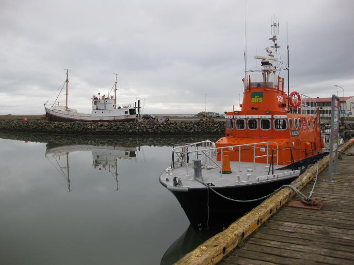
...and being a fishing town it has a small harbor.
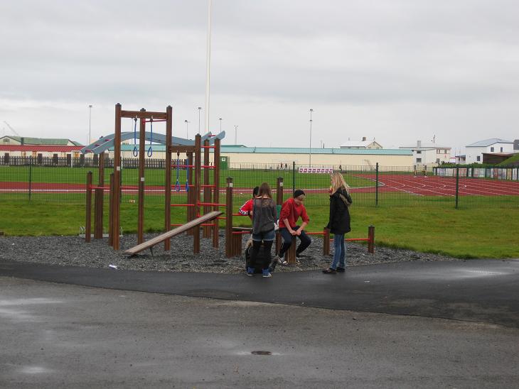
Icelanders like to keep fit, so even small towns have their
own sports complex with a soccer field, a thermal pool, an athletic track and
a matching set of loitering teenagers.
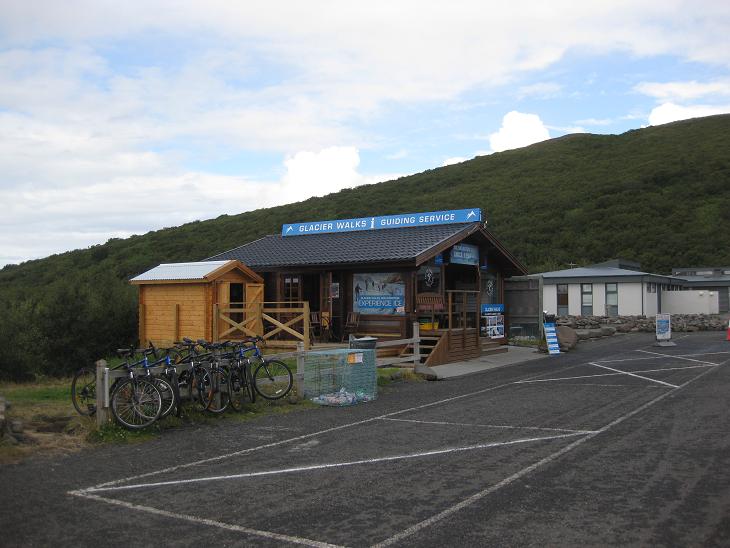
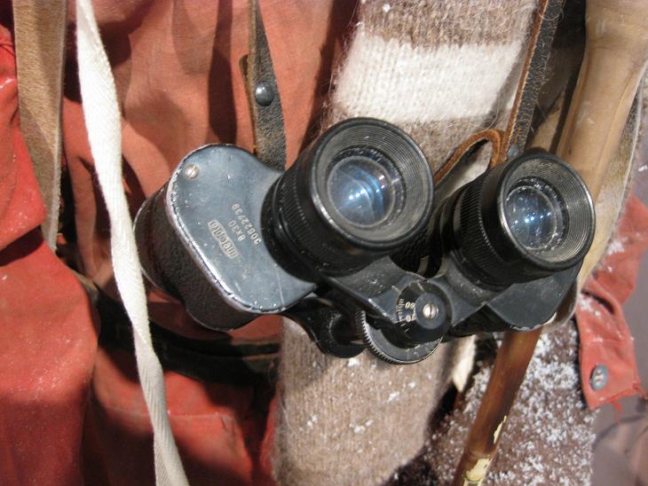
Hofn's main attraction is the Glacier Museum.
Since the poor weather made us skip the glacier walks,
we appreciated a well-made movie about Vatnajokull, the volcanic
activity underneath it and the floods and general havoc unleashed
in its neighborhood whenever Fire and Ice started their infernal tango.

When we entered the section depicting the life on the glacier,
my attention was caught
by a very familiar set of binoculars.
It was the same optical instrument made by the Czech company Meopta Prerov that
my dad used to use when I was a kid.
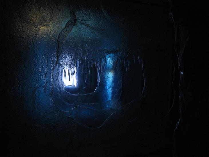
By far the coolest (no pun intended) part of the Museum was
the glacier interior simulator. A small cavity made out of plexiglass
and filled with sounds of dripping water magnified by numerous echos made
you feel like you had just been imprisoned in the real thing.
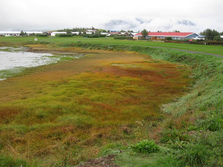
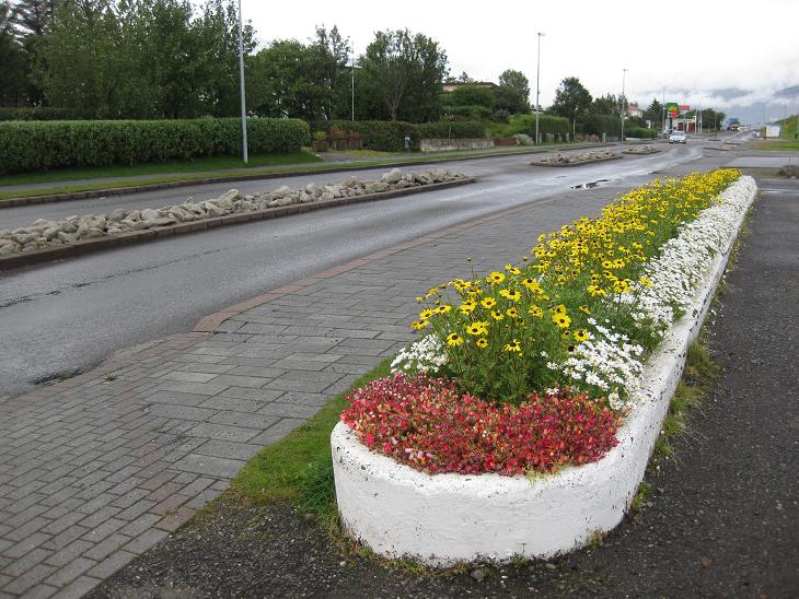
See grass is to Hofn what foliage is to New England.
It adds a few warm colors to its natural palette...
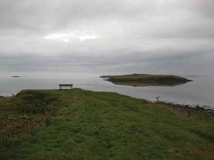
Today there was no sunset. But if it were Hofn was well prepared for it.
A bench to ponder where the ocean ends and sky begins.
Next ---
Index